

Descending toward the east from the high desert of Mitzpe Ramon the Aravah Valley is one of the most striking geographical features we encounter. Also called the Jordan Rift Valley, it is a continuation of the Great African Rift Valley that begins 5000 miles south in northern Tanzania and is responsible for monumental geological features such as Mt. Kilimanjaro.
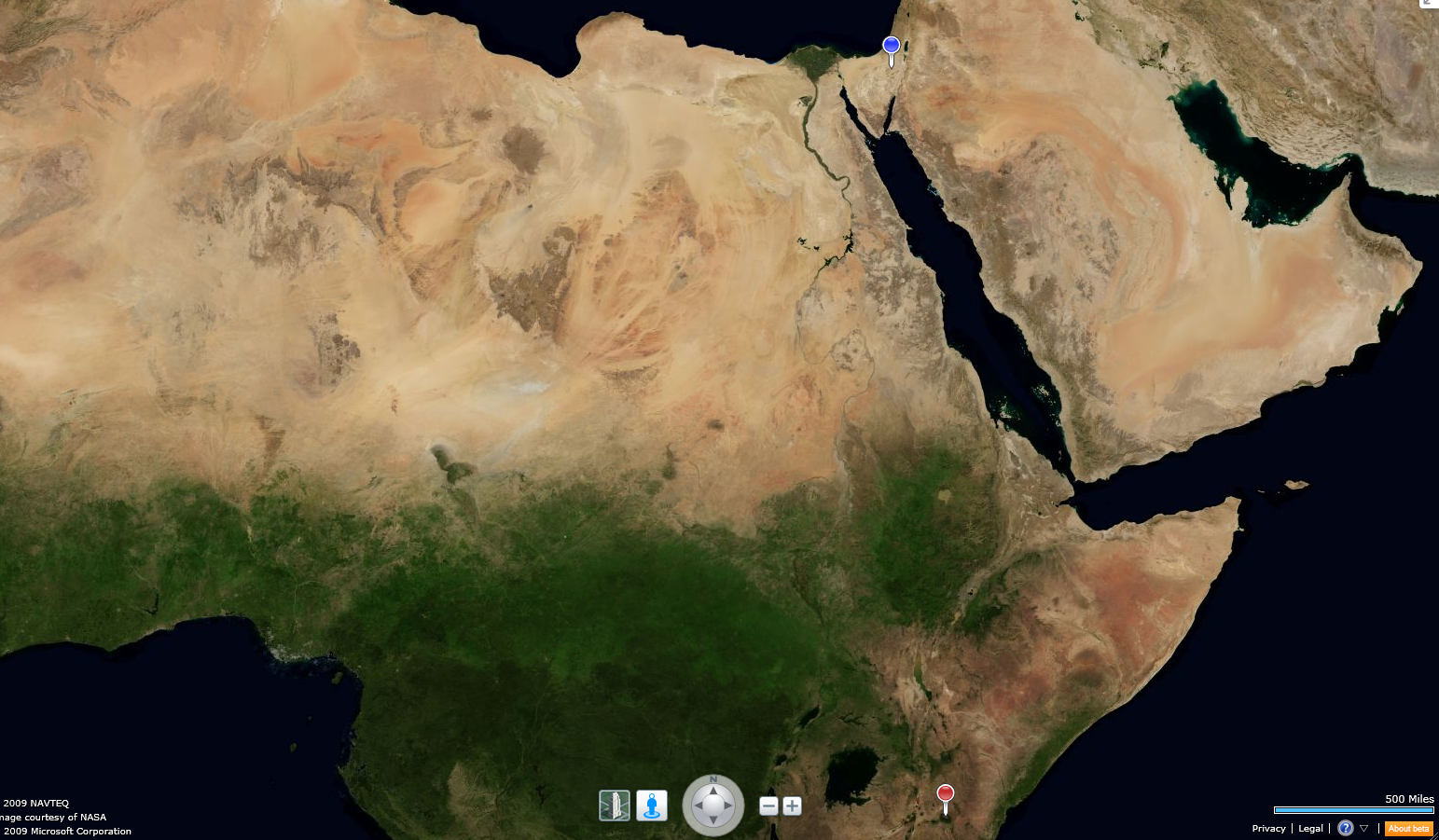
Great African Rift Valley system starting just below the red pin (Mt. Kilimanjaro) and running over 5000 miles north to the Aravah Valley between Israel and Jordan
I have always loved the sound of the name "Great African Rift Valley". It was discovered by British explorer and geologist John Walter Gregory on an expedition in 1892-3. Although now considered to be a number of related faults, rather than a single entity, the Great African Rift Valley conjures up far away mysterious places where wild animals call dangerously and the earth can swallow you up without a trace.
In Gonwonda land did Lawd decree
A great and steamy Tethys sea;
Where Jibjubs burbled and the Plythes did play
All throughout a Paleolithic day.
As the Arabian Plate pulls away from the African Plate, and the Indian Plate collides with both, the Great African Rift Valley and the Aravah Valley are formed.
Tectonics of the Great African Rift Valley and the Aravah Valley
Where the Great African Rift Valley enters the Middle East it becomes the Jordan Rift Valley, and farther north the Jordan River Valley itself. It is actually a fault in the earth's crust caused by the separation of the Arabian Plate from the African Plate as the Arabian Plate moves away, pulling to the northeast. Nowhere is this fault so prominent as where it runs between Jordan and Israel in the south, starting at Eilat from whence it runs north, becoming the depression that forms the Dead Sea, the lowest point on earth, and continuing north as the Jordan River Valley, The Sea of Galilee, eventually petering out in Northern Syria as the Bekaa Valley, home to various terrorists and other thugs. It is responsible for much of the geography and hence politics of the Middle East.
One encounters it all of a sudden, descending the serpentine road of the high desert, when the Aravah Valley suddenly heaves into view.

The valley itself is wide and flat, as much as 5 miles wide at its greatest width, and very red in color, with sharp, soaring peaks of basalt rising in three tiers to 5000 feet on the Jordan side (Arabian Plate), and lower, softer, terrace-eroded cliffs of sandstone on the Israeli side (African Plate). As one drives down Israel's Route 90 towards Eilat, the mountains on the Jordanian side become more sheer and ever higher, while the sandstone cliffs on the Israeli side become milder. The Thethys Ocean once covered this area some 220 million years ago. The Valley disappears into the sea when one reaches Eilat Bay, but the mountains continue to soar up until out of sight of land.
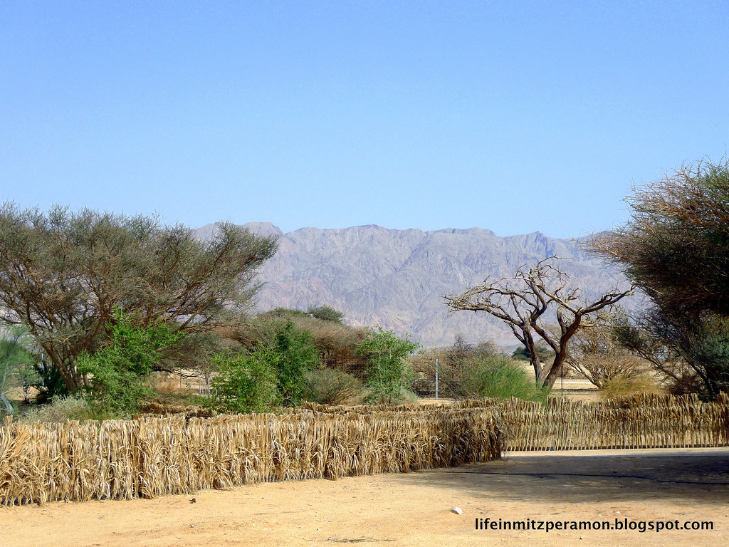
The Red Mountains in Jordan, forming the eastern boundary of the Aravah Valley
The terrain on each side of the fault is quite different, perhaps because of the fact that each belongs to a different tectonic plate with a different history.
Cliffs on the Israeli side of the Aravah Valley, forming the western boundary
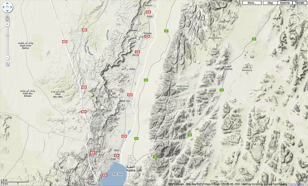
Topography of the Aravah Valley, just north of Eilat

No comments:
Post a Comment